Into the mist: trekking the Ring of Steall
5 comments
I’ve resided in Scotland for several months now and am well aware of the irresistible urge – the gravitational pull – towards the mountains, towards that wild freedom beyond the cityscapes. Although human hubs are exciting and offer a plethora of cultural goods – from folk fiddlers singing ancient anti-war ballads to chapel walls studded with disputed iconography – there’s nothing quite like taking yourself out for a breath of fresh air on winding trails nestled between snow-capped peaks.
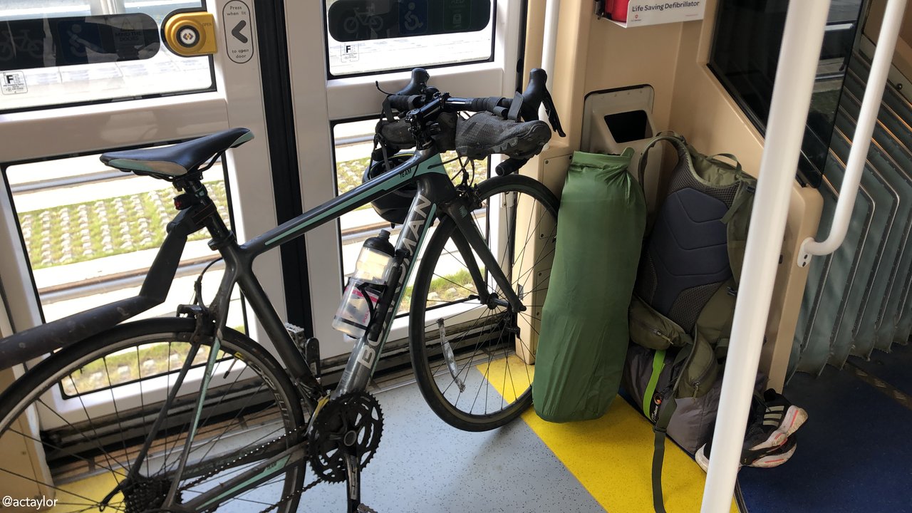
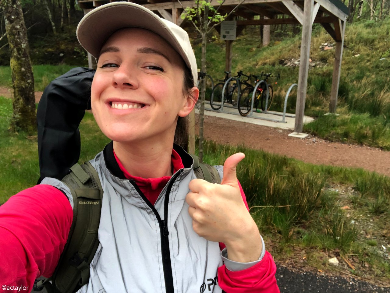
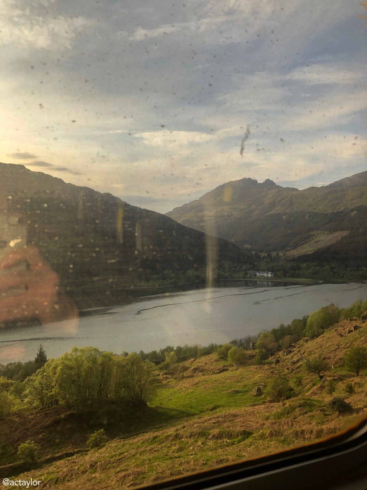 Tram to Waverley, then train to Fort William - bags in tow
I can’t quite explain it… perhaps you might understand… it’s not so much about dwelling on the past that takes me on these long silent journeys alone, but rather embracing the present with a newfound sense of confidence. These adventures – there’s something so empowering about taking your body out and testing its resilience, making time to get more familiar with yourself and how you work. Without being too self-gratifying, I’m impressing myself every day for the woman I am becoming. I love the independence, the self-assuredness - this version of myself, seemingly sculpted from awe-inspiring and adrenaline-fuelled trips.
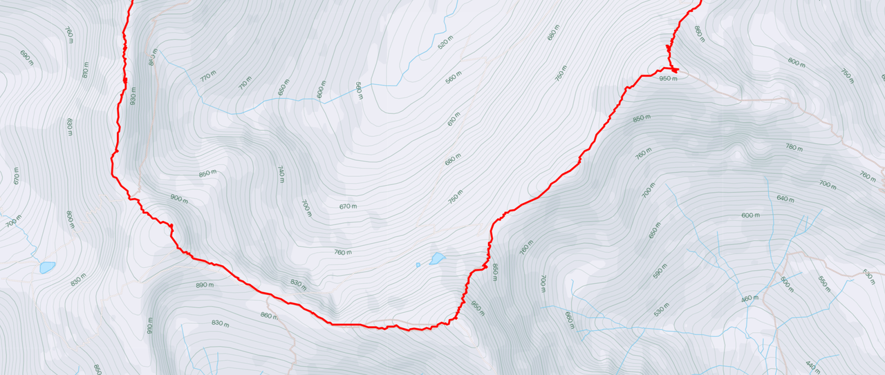
The Ring of Steall, situated near the town of Fort William, forms part of the Mamores mountain range. (“Mamores" is derived from the Gaelic "Na Meòrachan," which translates to "The Big Ridges.") There are ten Munros (mountains in Scotland over 3,000 feet) in the Mamores – and the Ring of Steall traverses four of them - namely Sgurr a' Mhàim, Stob Coire a' Chairn, An Gearanach, and Stob Choire a' Mhail. Like much of Scotland, the Mamores were heavily influenced by glaciation during the Quaternary period, which began around 2.6 million years ago and continues to the present day – and with this in mind I was especially interested in the geology… But more on that later.
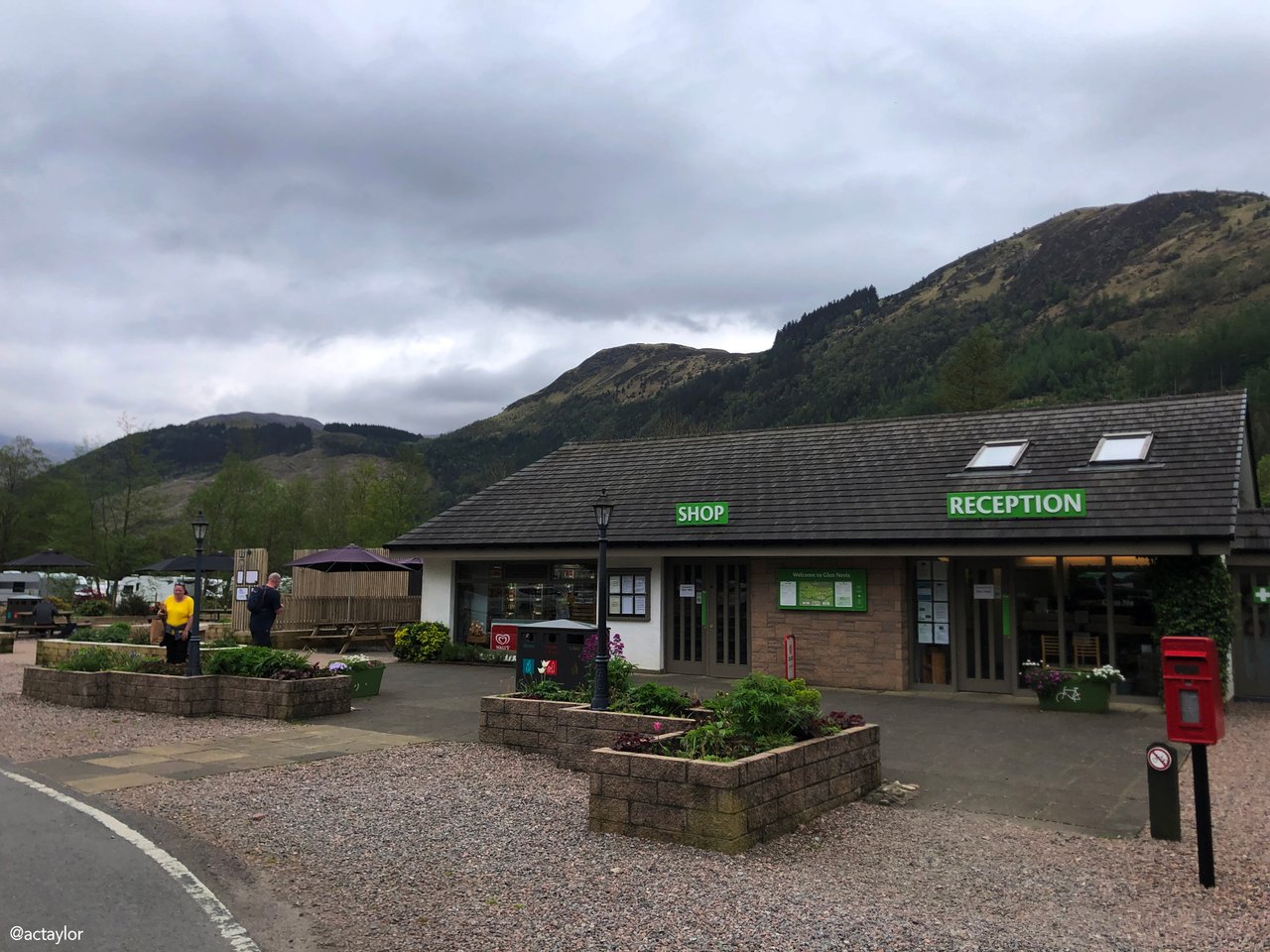
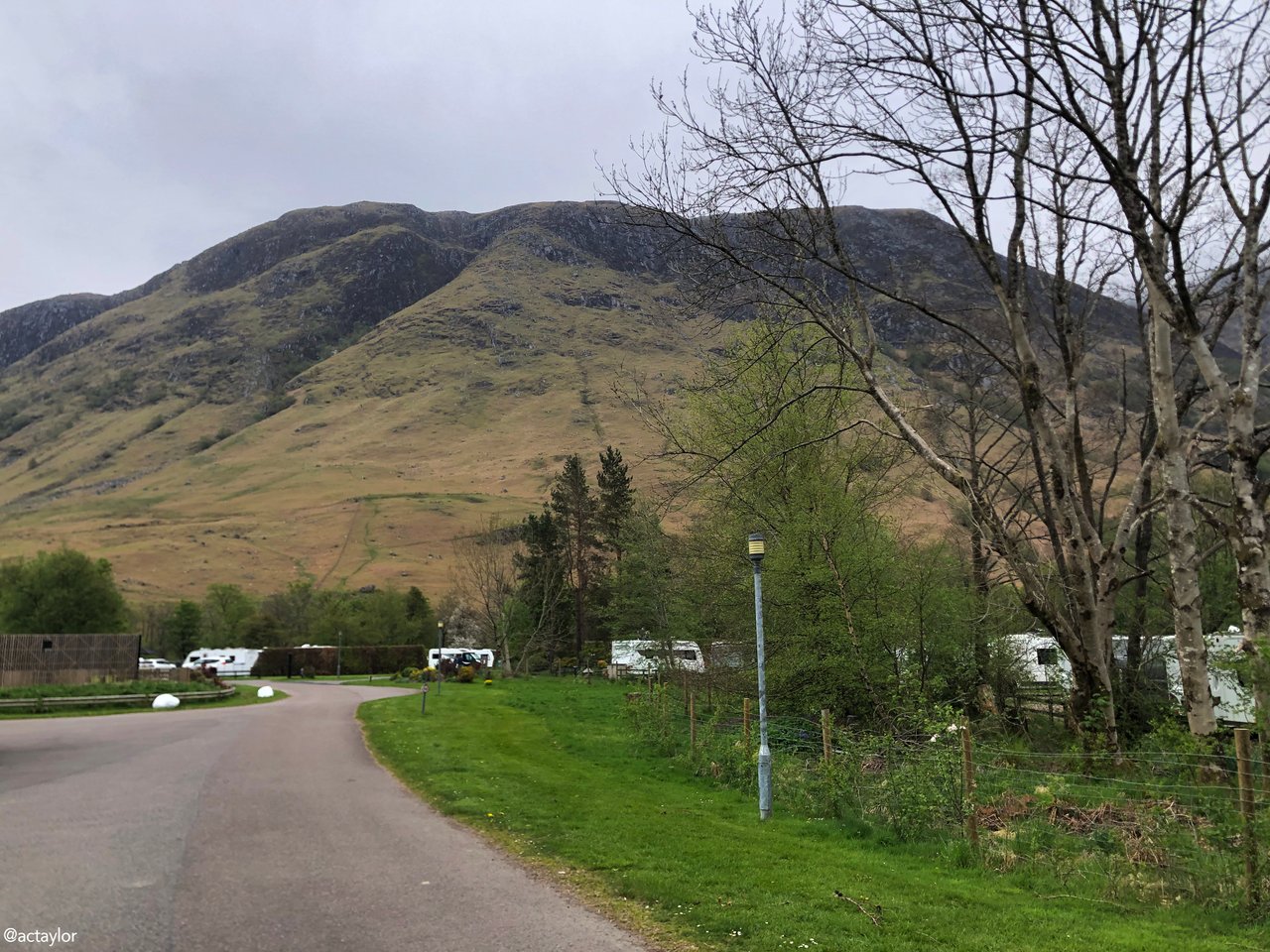
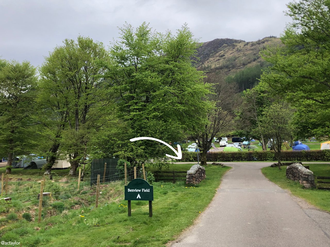
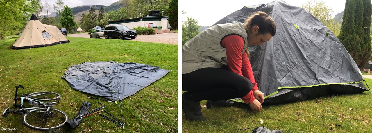
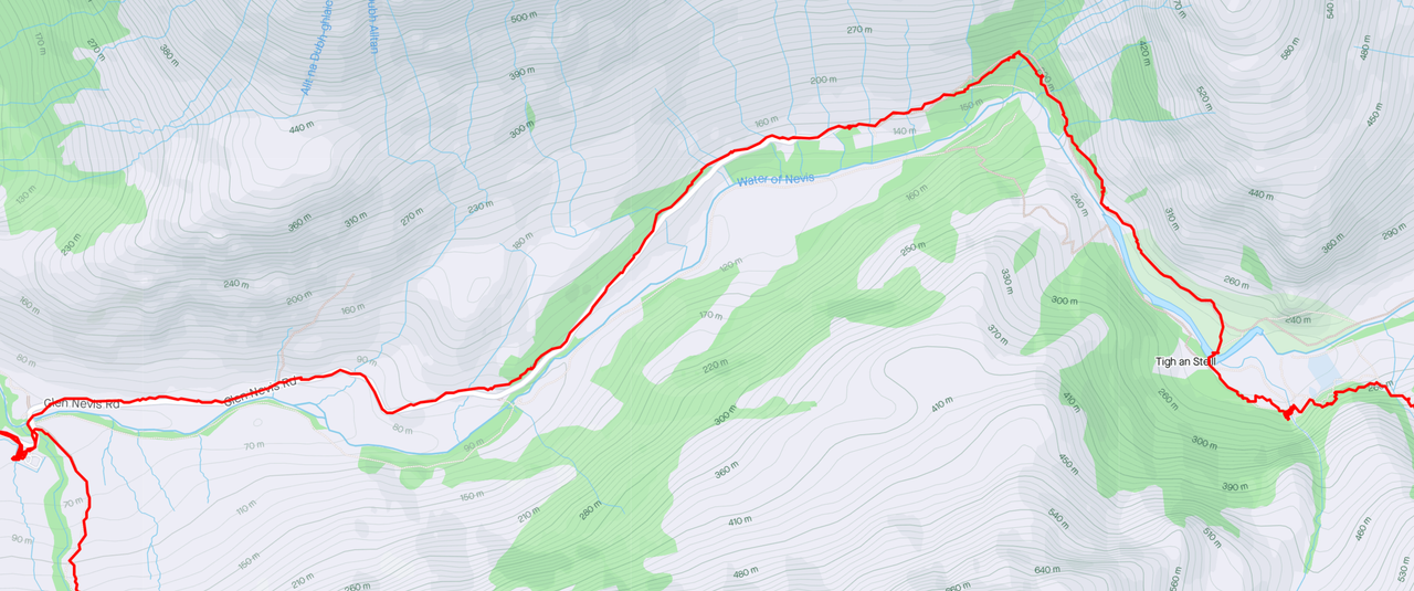
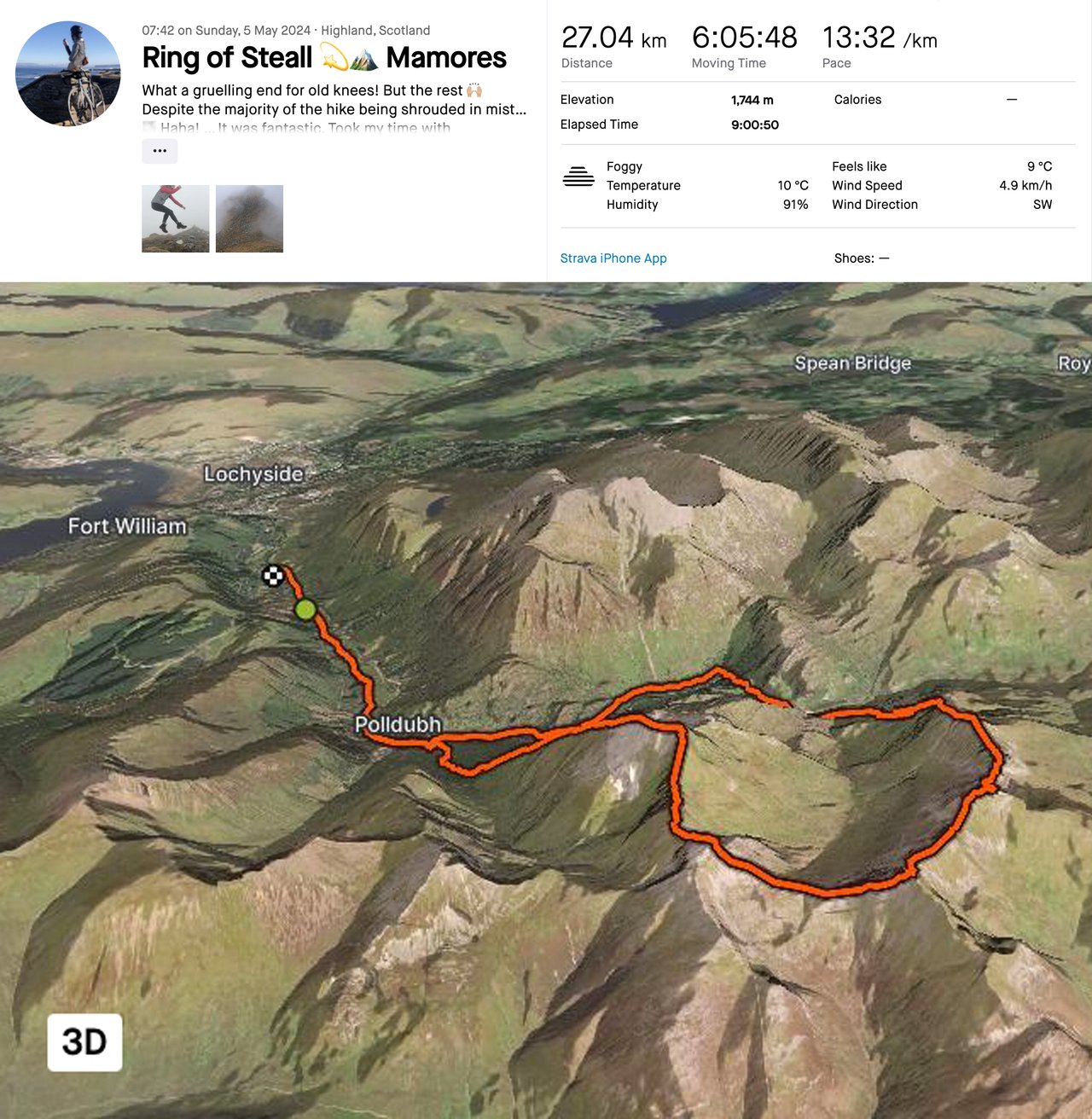
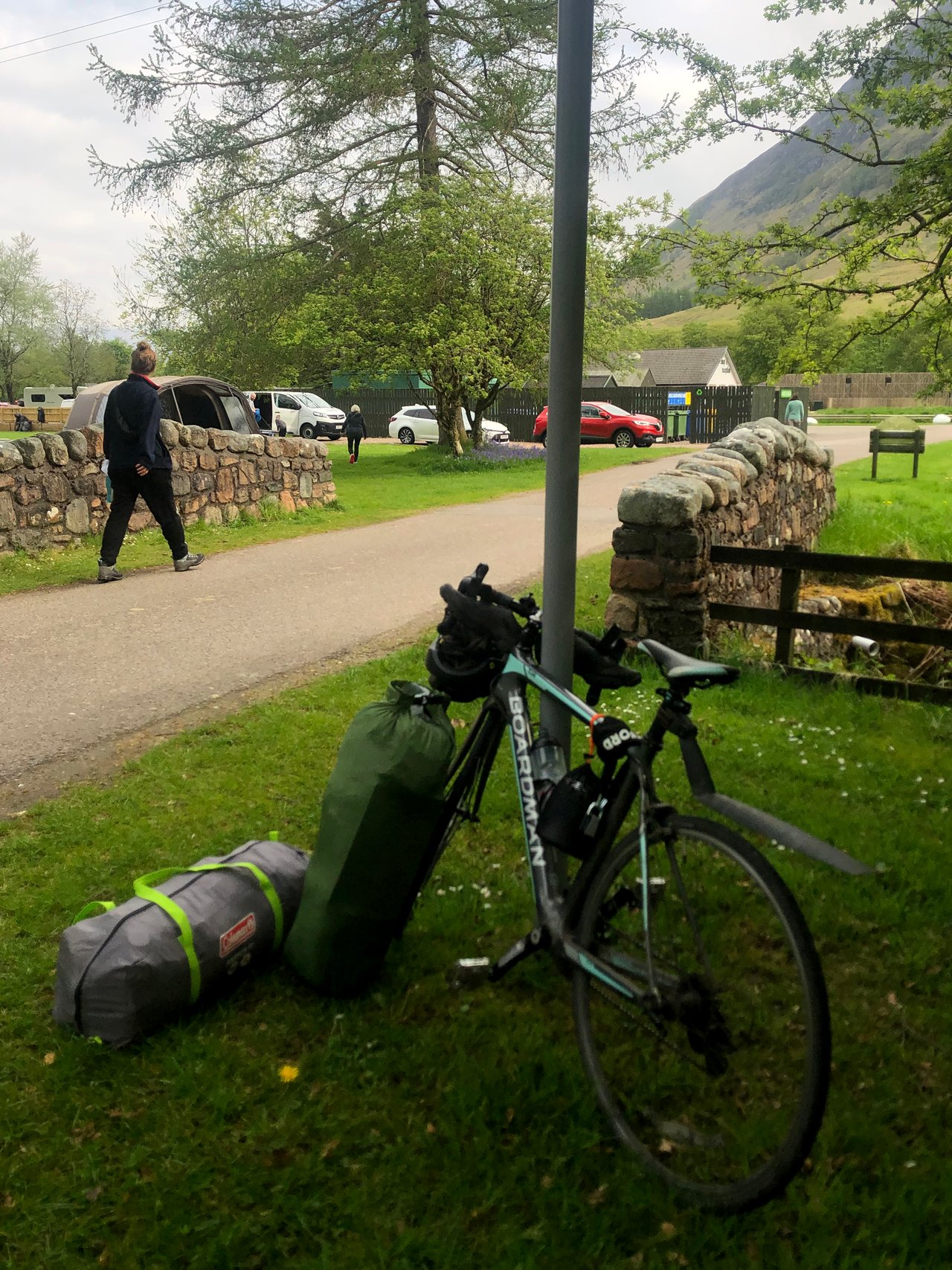
Now, depending on what direction you head in, you can follow the circuit across the peaks from either Lower Falls or the parking lot up Glen Nevis. As I did not have a car (and was camping with my bike at the Glen Nevis camping ground), I decided to cycle fifteen minutes to Lower Falls and hike from there in a clockwise direction. This presented a nice 45-minute warmup on the flat road past Paddy’s Bridge.
However, when I was buying my map at Nevisport, I was advised to hike the Ring in an anticlockwise direction. The reasons for this were: it’s better to attempt the steep cliff of Stob Choire a’ Mhail on the incline; the views are more impressive from this direction; and you will no doubt get your feet wet in the Steall Falls – “better to do this at the end of the hike than at the start!” Although I did not take the guide's advice, I’m glad I went clockwise… for reasons I’ll get into soon.
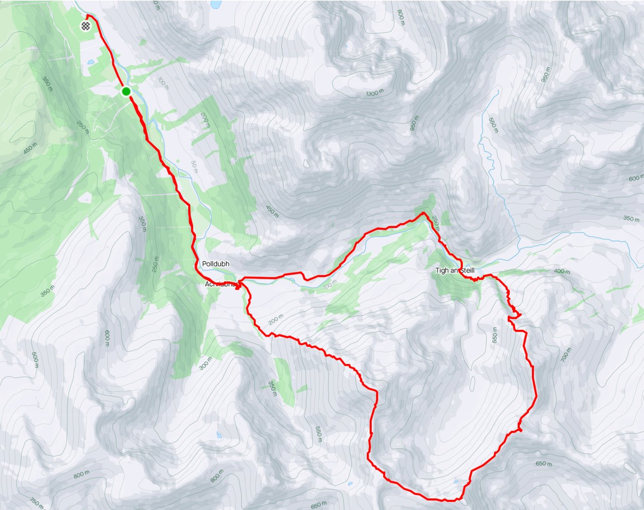
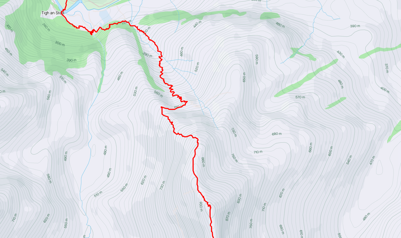
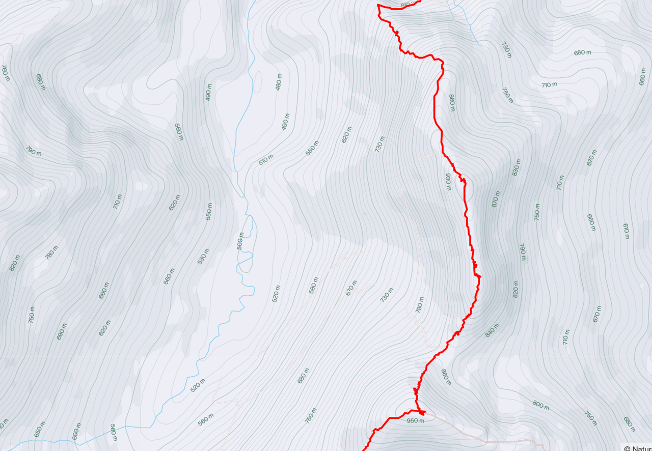
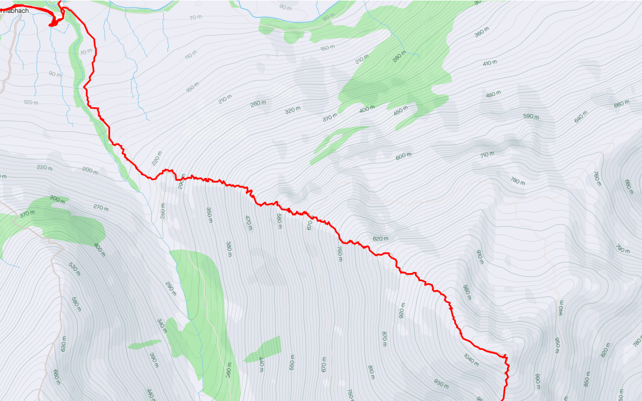
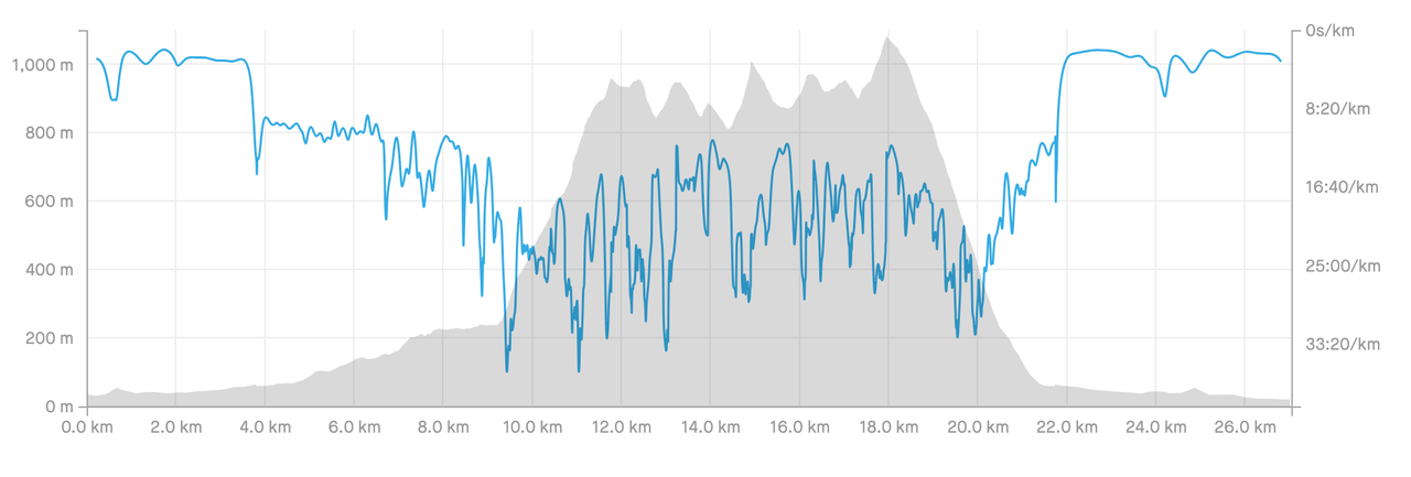
Regarding maps... although you should always carry an alterative or backup means of navigation (hence the hardcopy), I found the most accurate Ring of Steall GPX route on the Walkhighlands site, accessible here. And the online route map is accessible here. I then uploaded the GPX file to Strava and recorded the hike there. It is easy enough to follow the trail here, but it must be noted that the file did not contain actual mapping. Therefore, the hardcopy map and compass were essential, especially near the end of the hike when the route forked twice.
So, let’s begin…
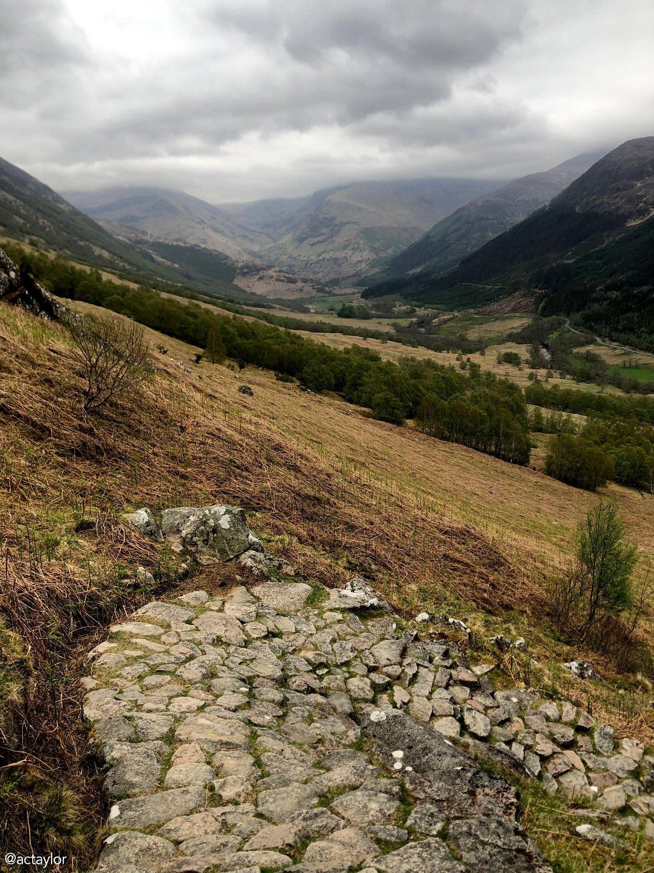
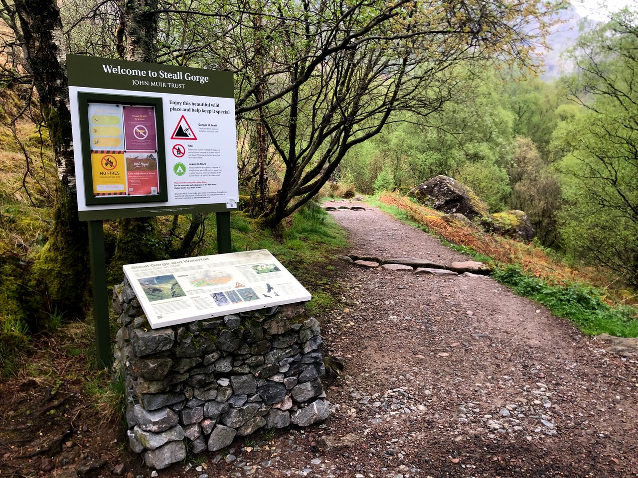
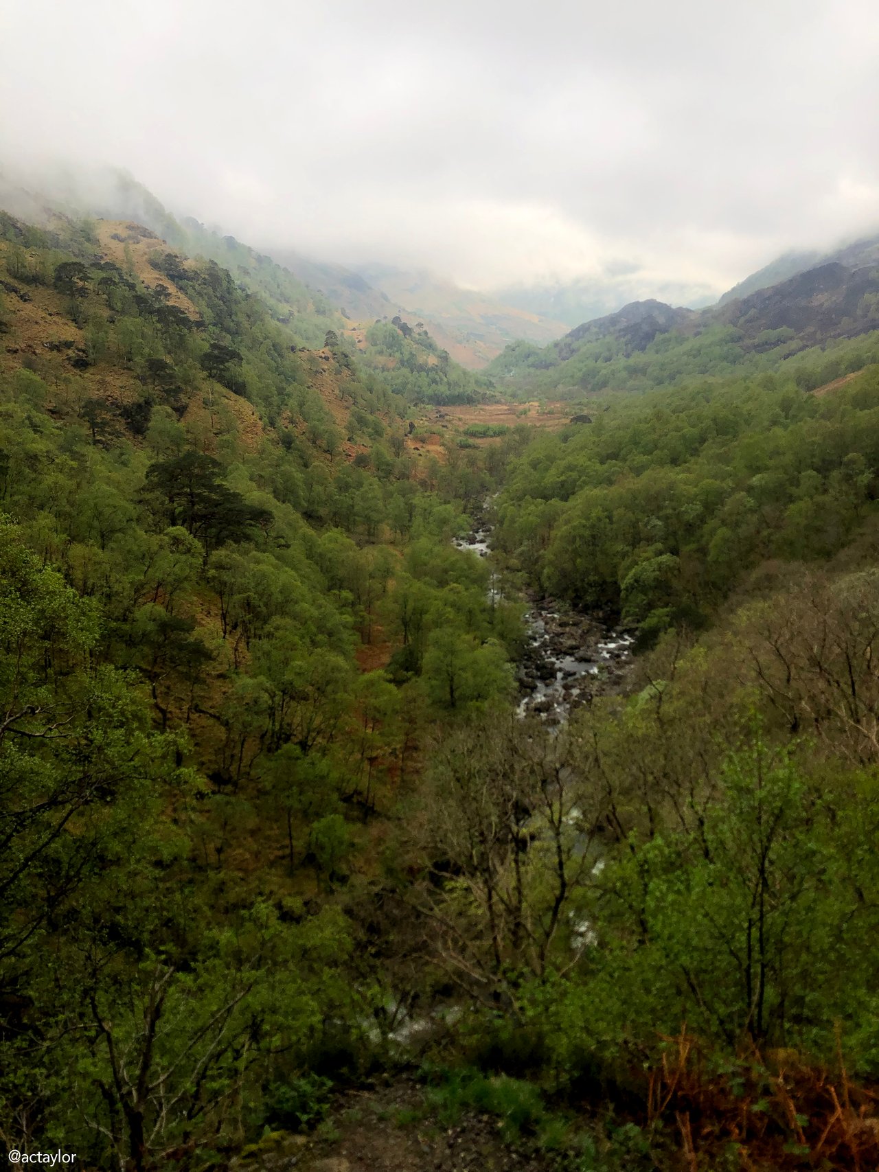
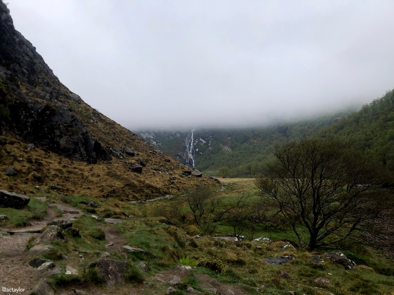
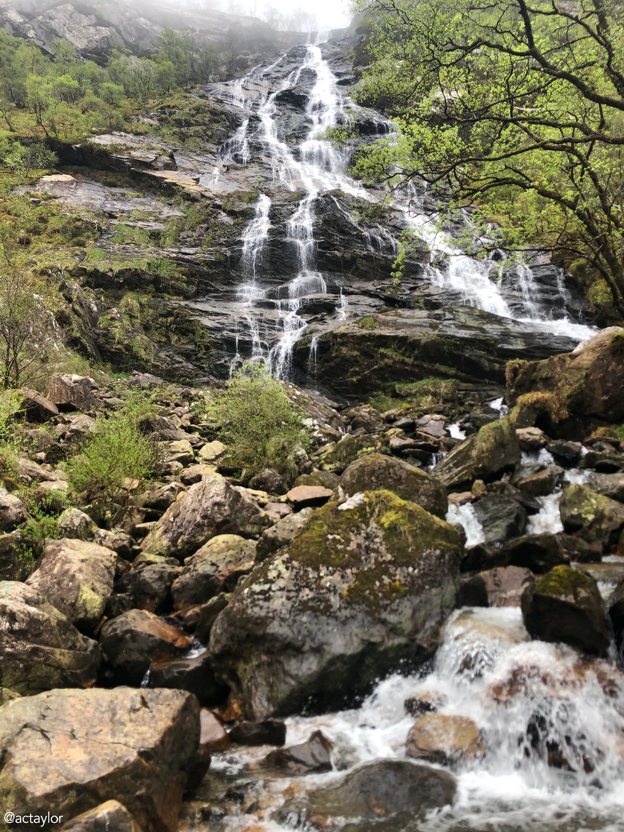
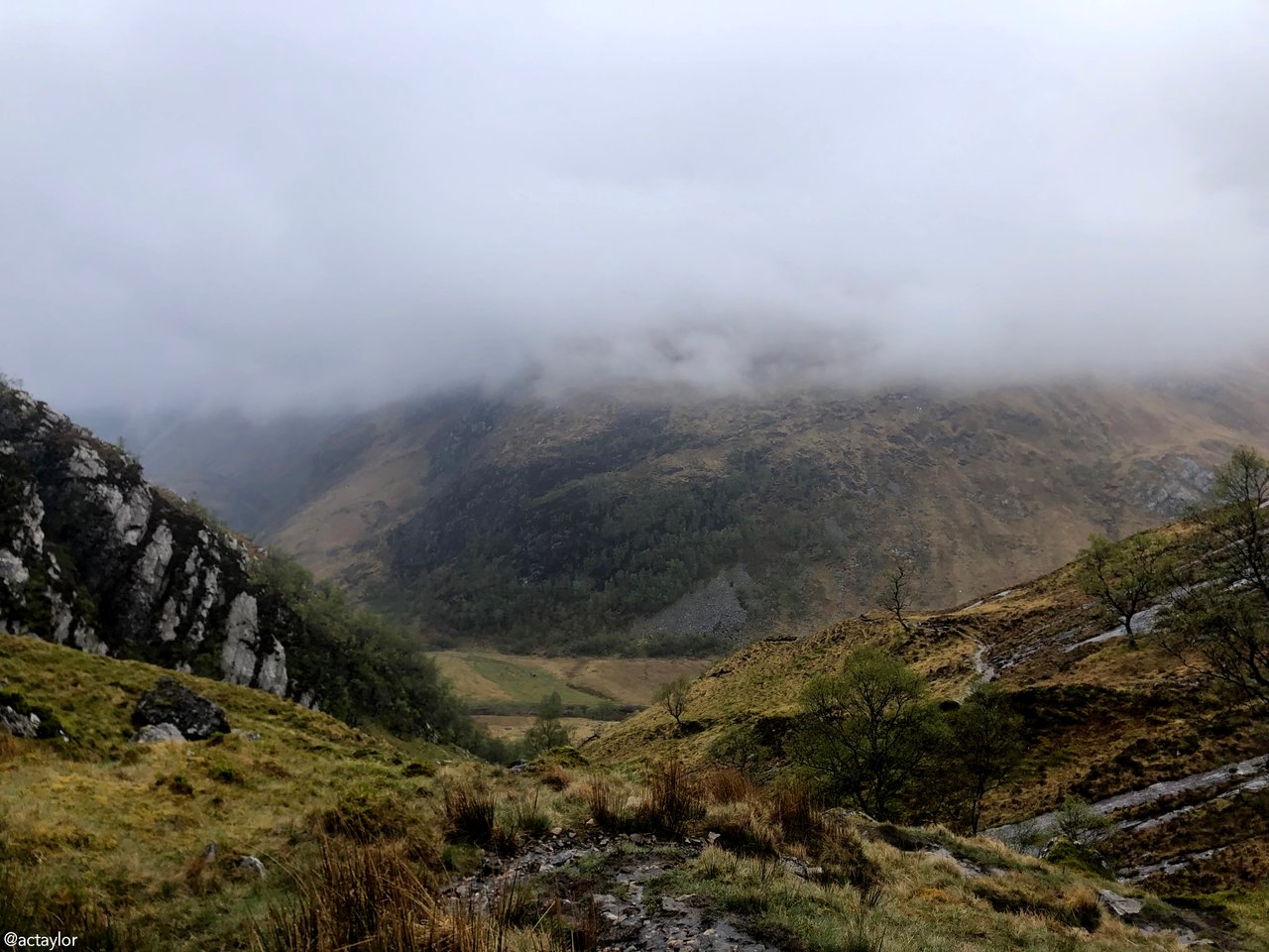
If you follow the main trail in a clockwise direction from the parking lot up Glen Nevis, it begins by taking you through a lush deciduous forest where the path, though well-trodden, intermittently transforms into rugged terrain beneath your feet. The glen gradually twists and turns, weaving its way to the right, creating a narrow passage flanked by sheer cliffs. Take a look at the panoramic spectacle below. At the heart of this scene, the pièce de resistance: the awe-inspiring Steall Falls. Cascading a staggering four hundred feet down a fractured cliff face, it adds a breathtaking beginning to the grandeur of the Ring of Steall hike.
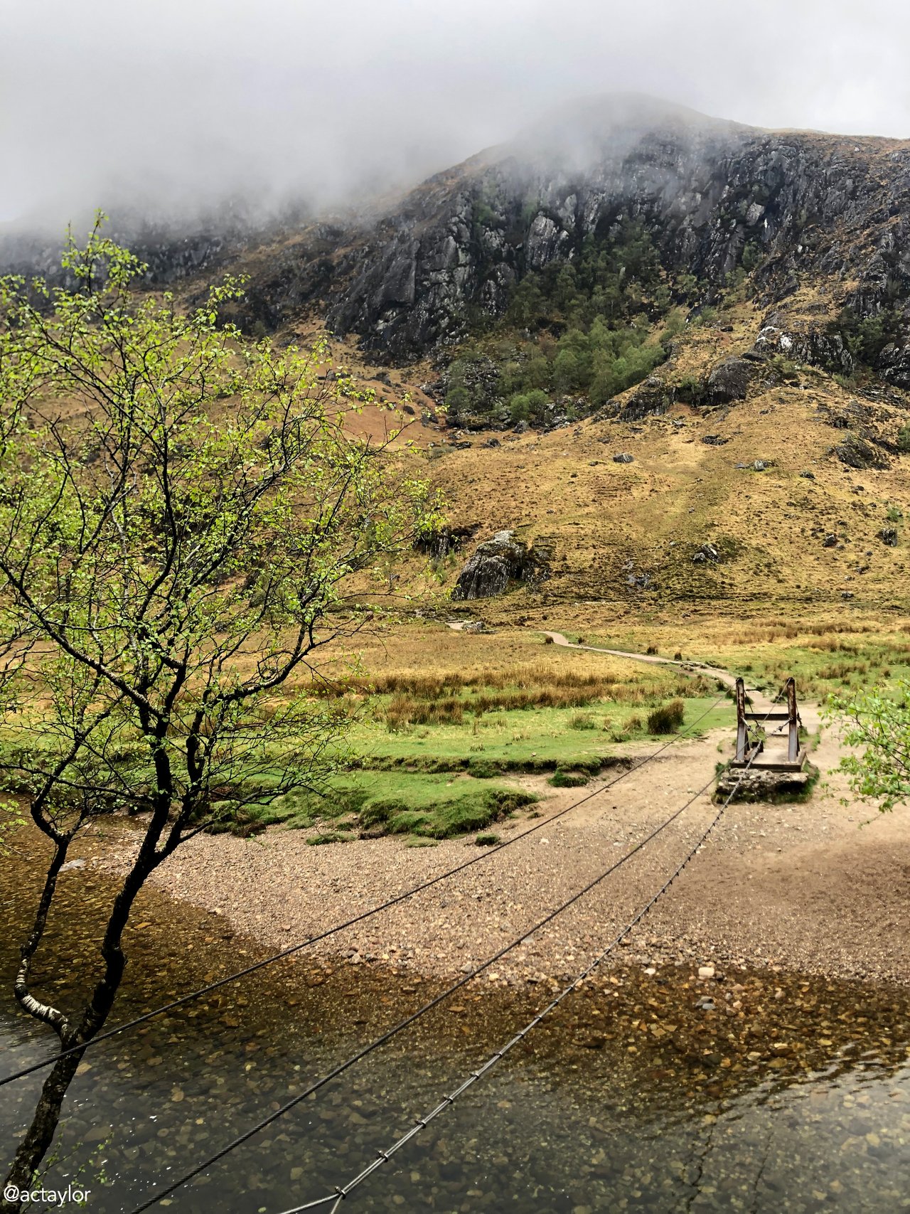
The steel-cable bridge, comprised of three cables - two serving as handrails and one sturdy enough for boot balancing - was described as “an exhilarating challenge for the adventurous souls who dare to cross it”. Suspended high above the rushing river, its bark was worse than it’s bite – as they say. For those preferring a more cautious approach, an alternative route involves wading through the shallow waters just upstream, a feat obviously rendered impossible during periods of heavy rainfall.
Upon reaching the opposite bank, you then turn left, passing by the Steall Hut, a private refuge. Here, you'll encounter the burn, where stepping stones offer a precarious crossing at the very foot of the majestic Steall Falls. Word of caution: do not be fooled into thinking that those stones make an easy crossing.
Oh no.
Confident and a little too smug at my prowess with the steel-cable bridge, I hopped onto the first rock. Unbeknownst to me, it was covered in a coat of algae. I slipped off it - with a surprised squeal - straight into the chilly water. With two drenched both boots and my tail between my legs, I scrambled back to shore. Bother! Fortunately, I’d packed a fresh pair of socks. (Someone has to look after the lass!) And it didn’t take long before I was back on my way, laughing at myself.
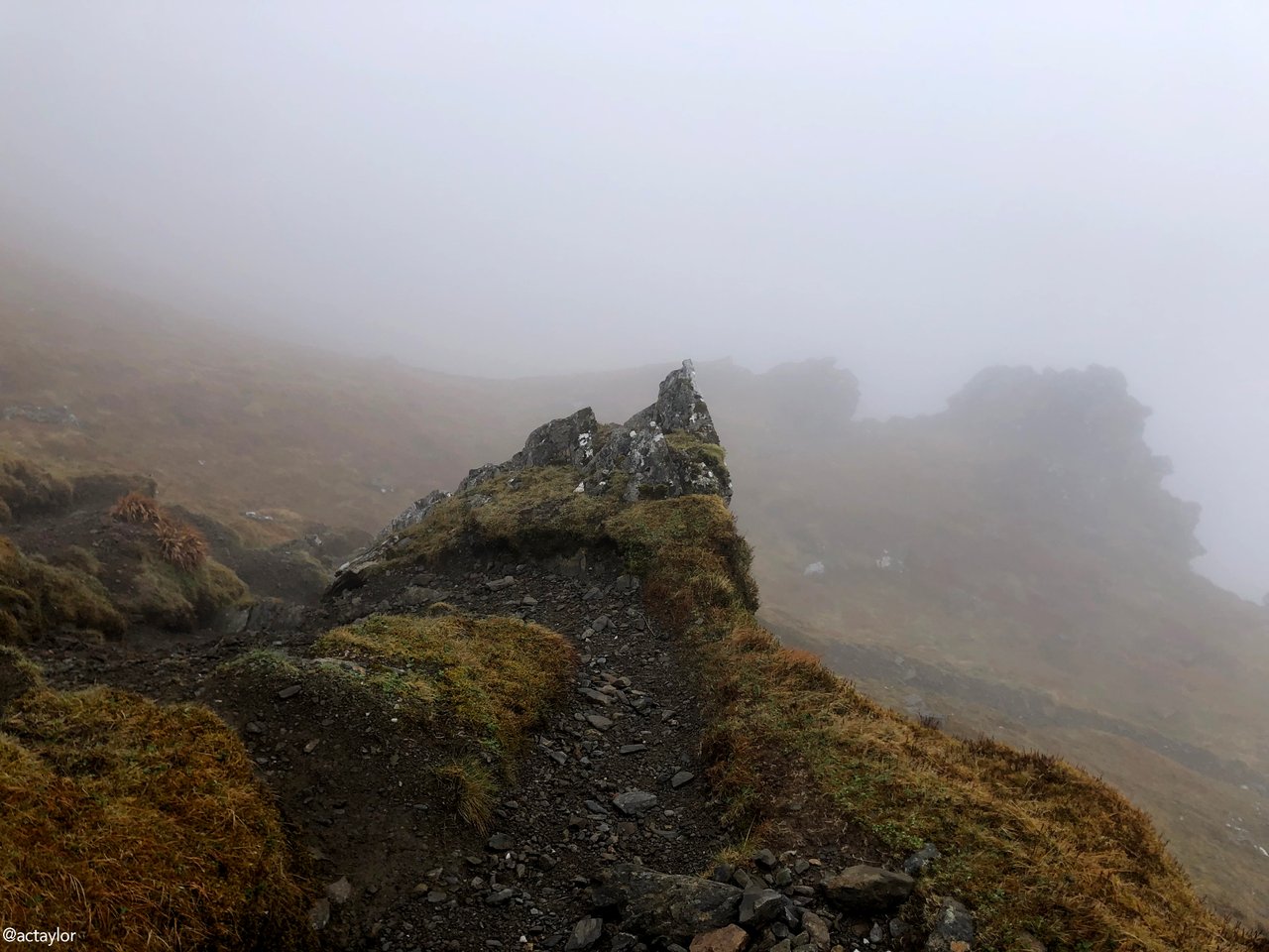
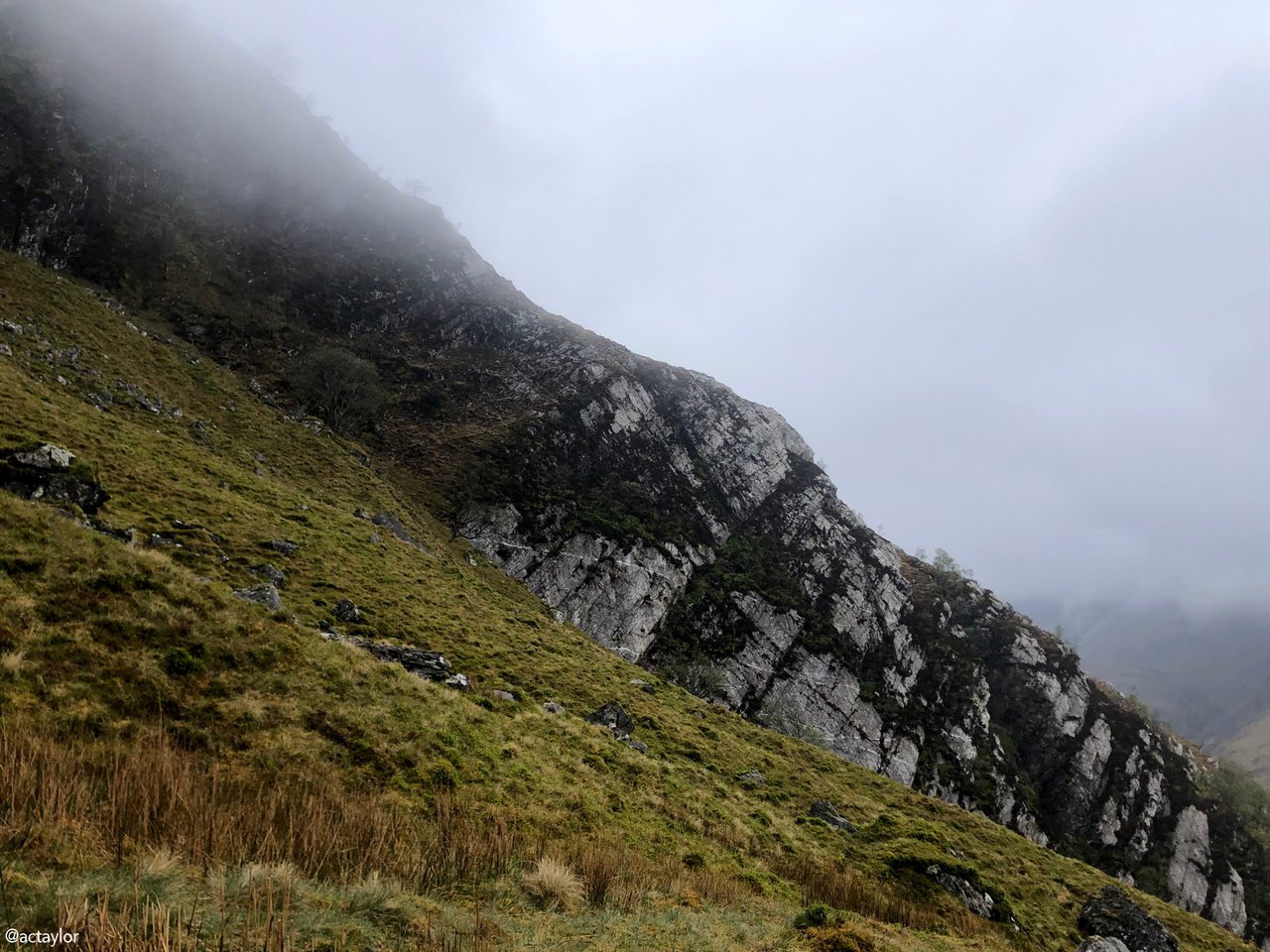
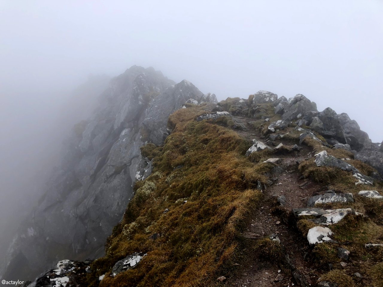
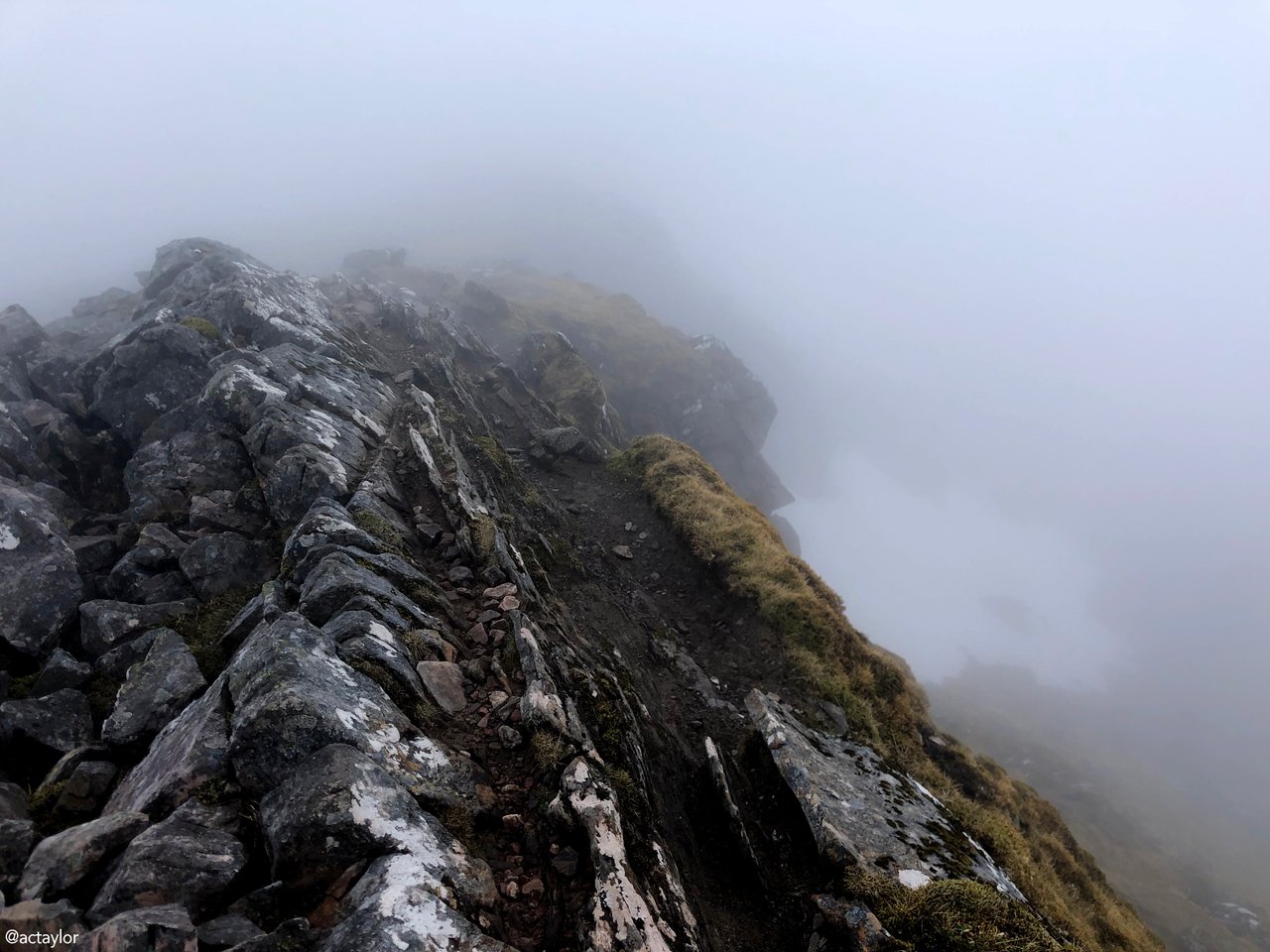
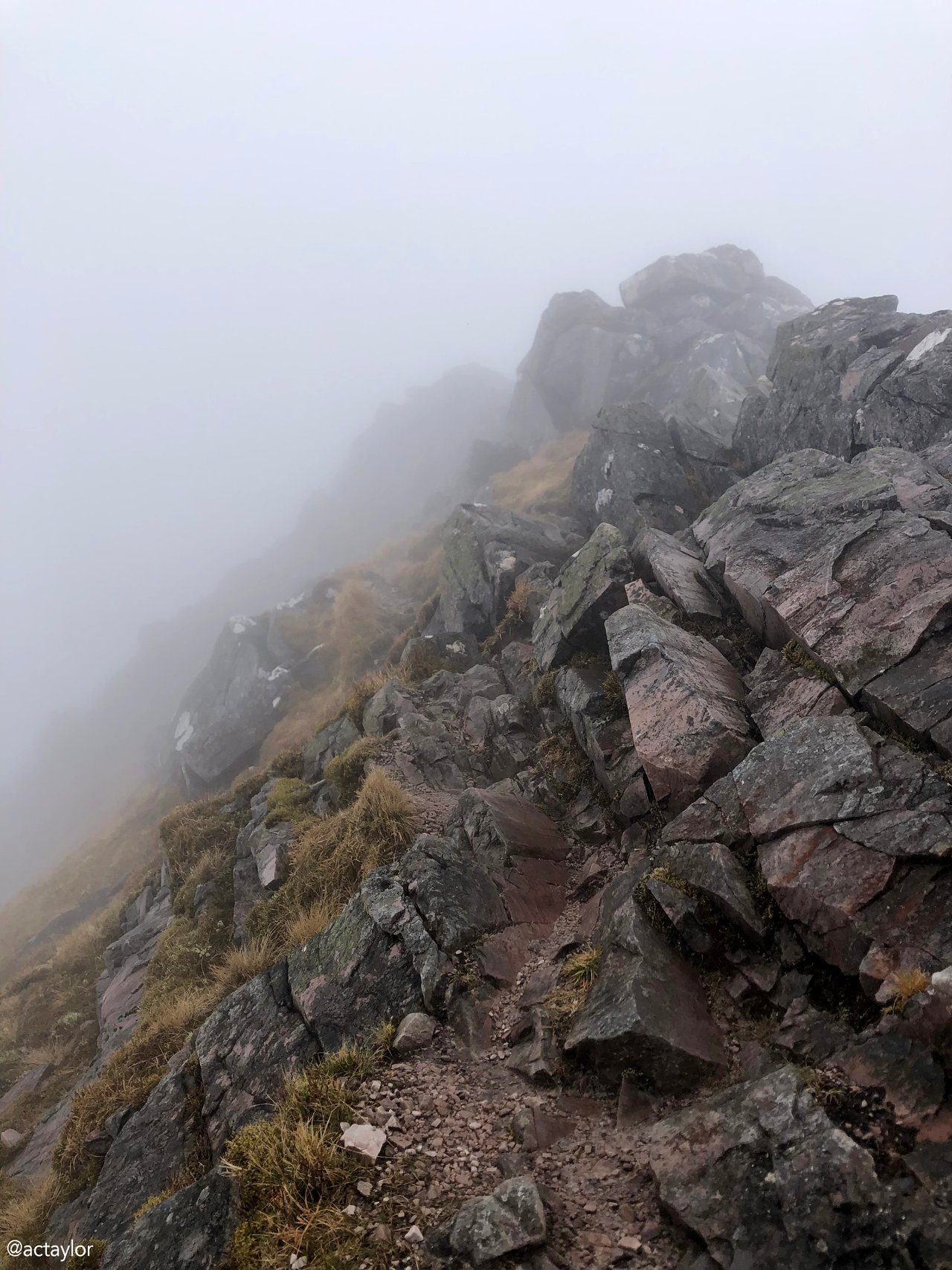
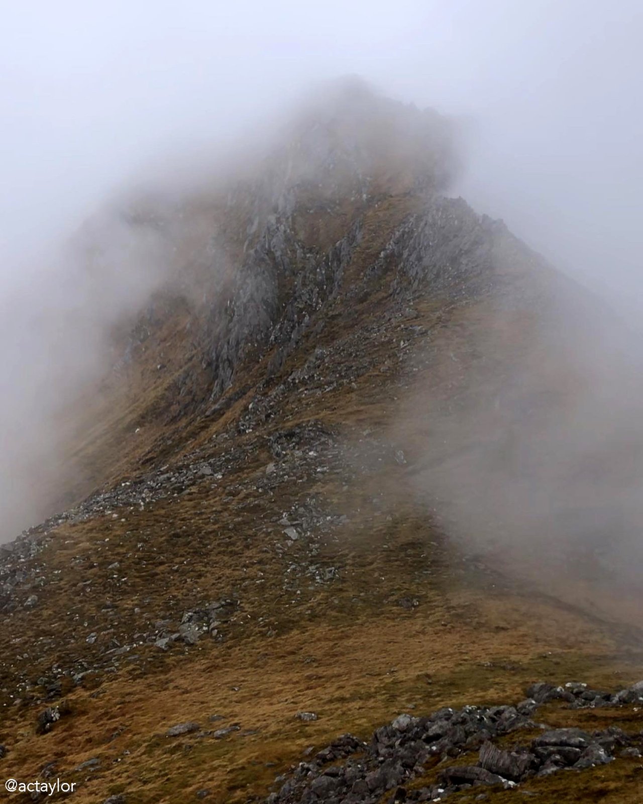
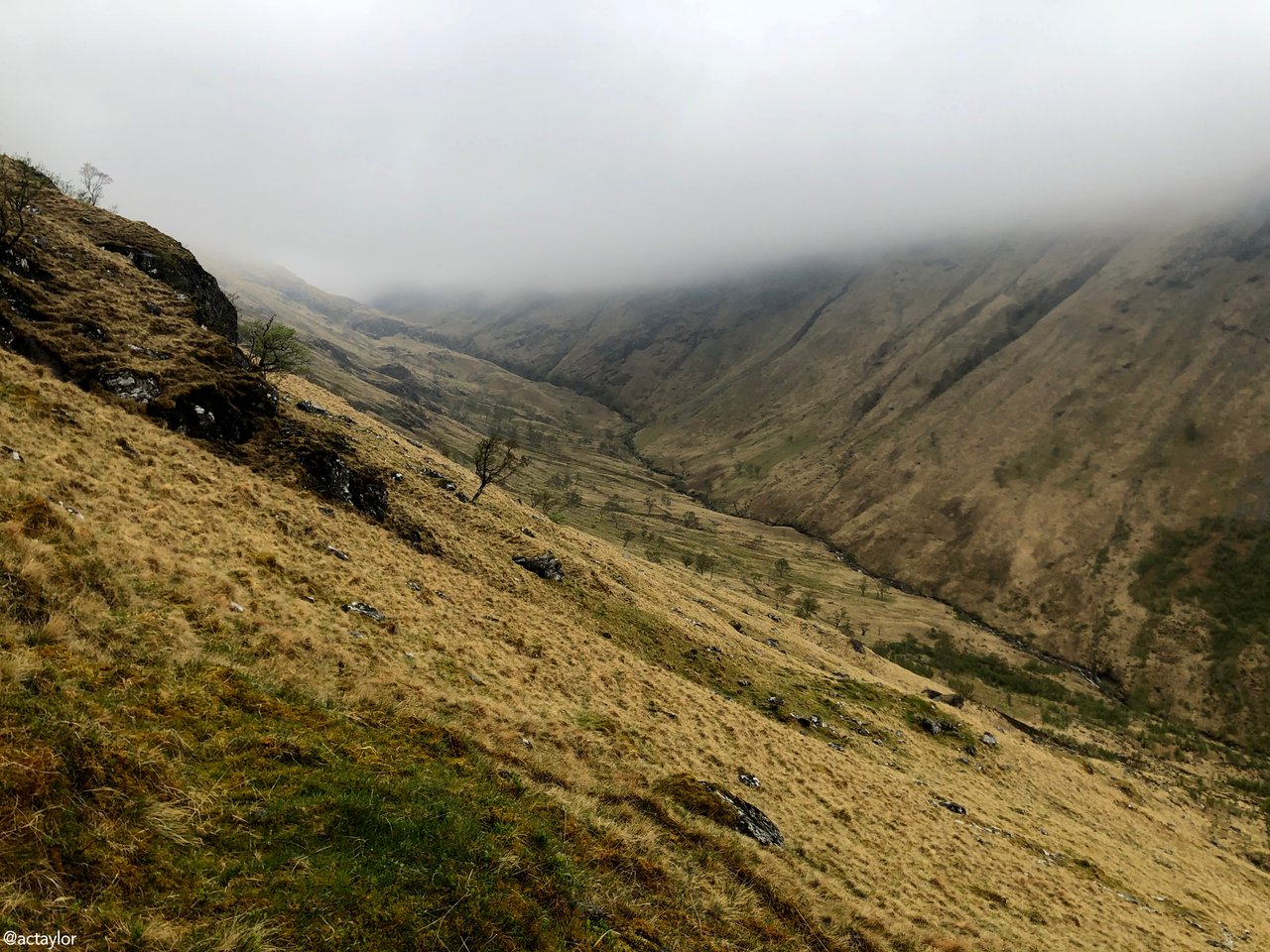
The stalkers' path, leading uphill, marks the first climb. As you ascend, you'll reach a point where a landslip has altered the path's original course. Fear not, for the route continues steeply beside this, and presents a wonderful view back into the Steall Meadows. As you progress, the path improves, eventually traversing across the corrie before zigzagging uphill towards the grassy ridge ahead. Here, I entered into a light cloud that didn’t disperse, except on occasion, for the entire hike – despite the forecasted 20% visibility.
So, you aren’t going to get many brilliant scenic pics from me, I'm afraid... if you want to get a sense of the hike’s true beauty, do please check out @natubat’s post on the @pinmapple map: “Walking the Ring fo Steall, Glen Nevis”. She did the hike in perfect weather! I, unfortunately, spent most of the walk submerged in an obstinate cloud that refused to shift despite my pleas.
This, my friends, is Scottish weather in a nutshell.
But there's also something quite ethereal about being in an unfurling fog... something special about catching bare glimpses of craggy tops. They wink at you before retreating back into secrecy. It can be spellbinding, mystical...
Still, a bit of sun and blue sky would have been nice.
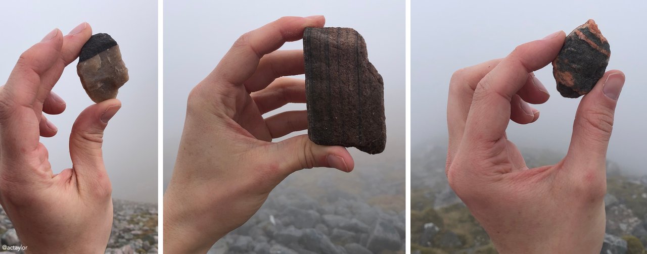
After navigating the initial steep section, the ascent becomes gentler, guiding you through a straightforward grassy terrain before the final push to the summit of An Gearanach, standing proudly at 982 meters. Here, I pocketed my first stone. In case you didn’t gather from my puffin post, I have a weakness for stones, rocks and pebbles. As a child I took great pride in my semi-precious stone collection. From amethyst, turquoise, agate and tiger’s eye through to fool’s gold, jasper, obsidian and aventurine – I stored them all in little plastic drawers that I’d spend hours simply admiring alongside my collections of stamps and coins. Yes, I was that kind of kid.
... I suppose some things don’t change.
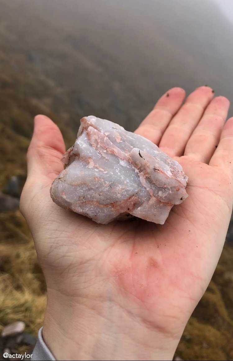
My first keepsake found along the Steall was a quartzite stone, a metamorphic rock formed from sandstone through metamorphism. The delicate pinkness is a result of microscopic inclusions of aligned silicate mineral fibres – trace amounts of titanium, iron or manganese. I found it on the snaggy road between the first two Munros – a pretty sort of rock, which is ironic as quarts is a frequent feature on rocky outcrops and is known for its hardness and resistance to weathering.
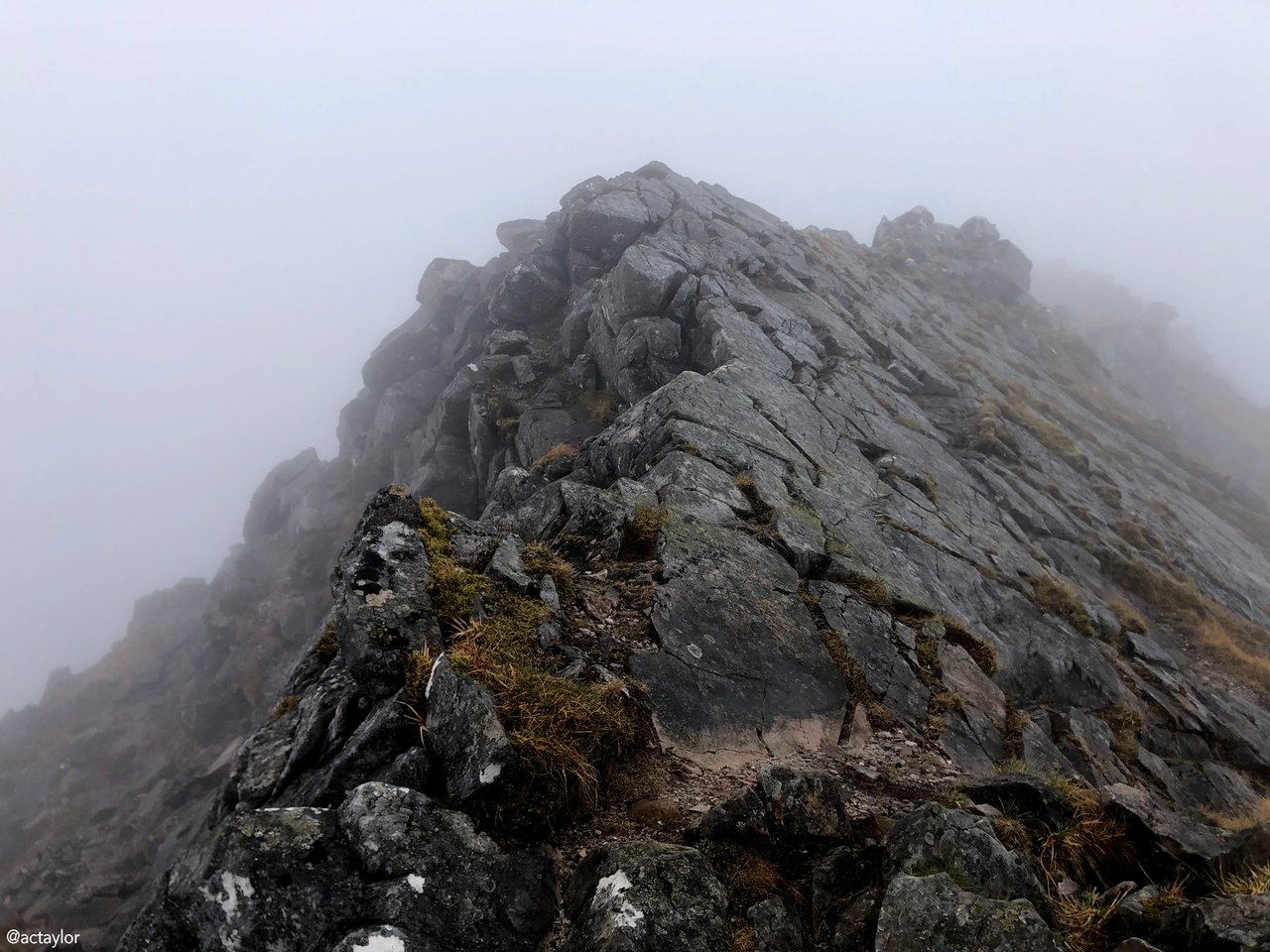
Continuing along the narrowing ridge, you then reach An Garbhanach. Traversing this 'top' requires a bit of airy scrambling. If you’re fine with going on all fours for a bit, and have a head for heights, then you’ll be fine. I’m not going to lie – I definitely had two or three moments of vertigo and had to backtrack. In these moments I was so very grateful for the light fog obscuring the drop, as well as the lack of wind. I was also grateful at having taken the clockwise route, as I’m convinced that slowly climbing the steppingstones at an angle against the ridge is far easier than attempting to descending them with a view of the sheer drop below. At the next bealach, the scrambling continues, eventually leading you to Stob Coire a'Chàirn, the second Munro of the day at 981 meters.
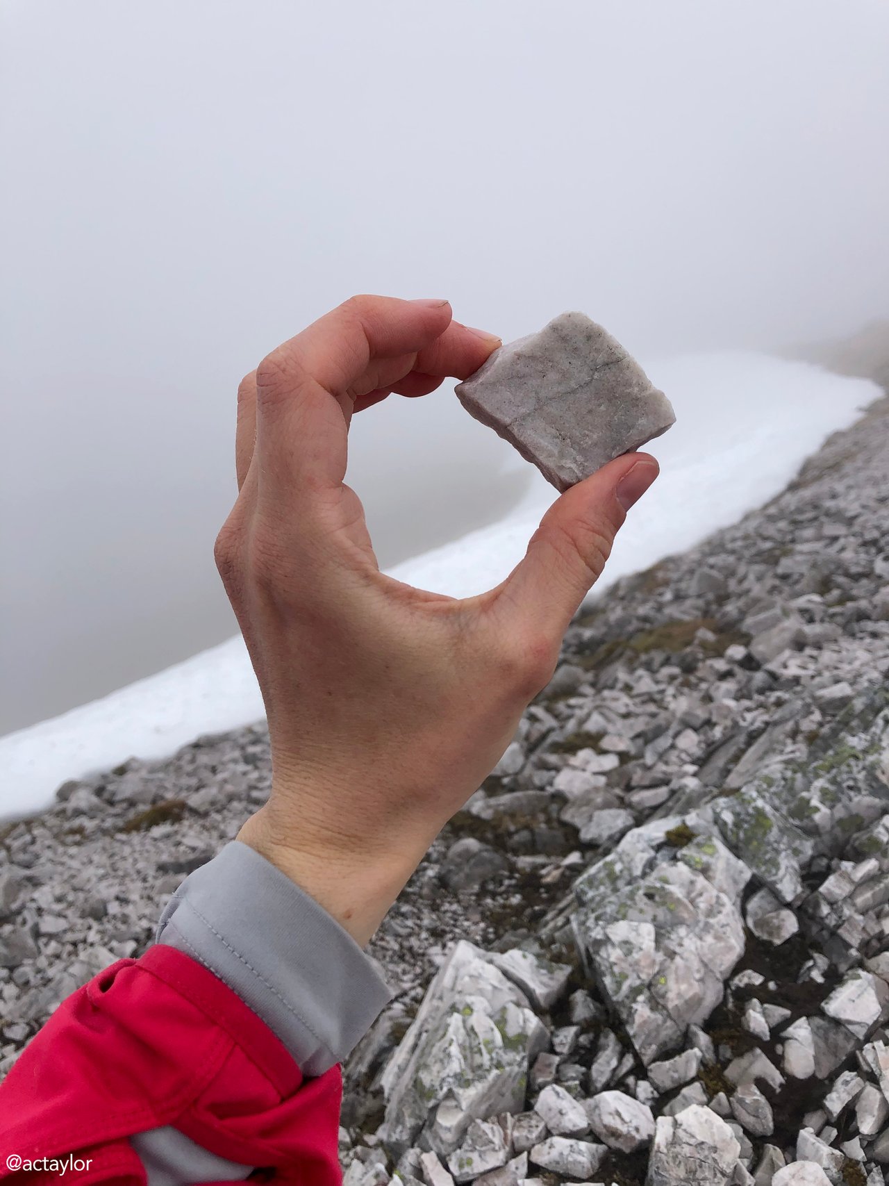
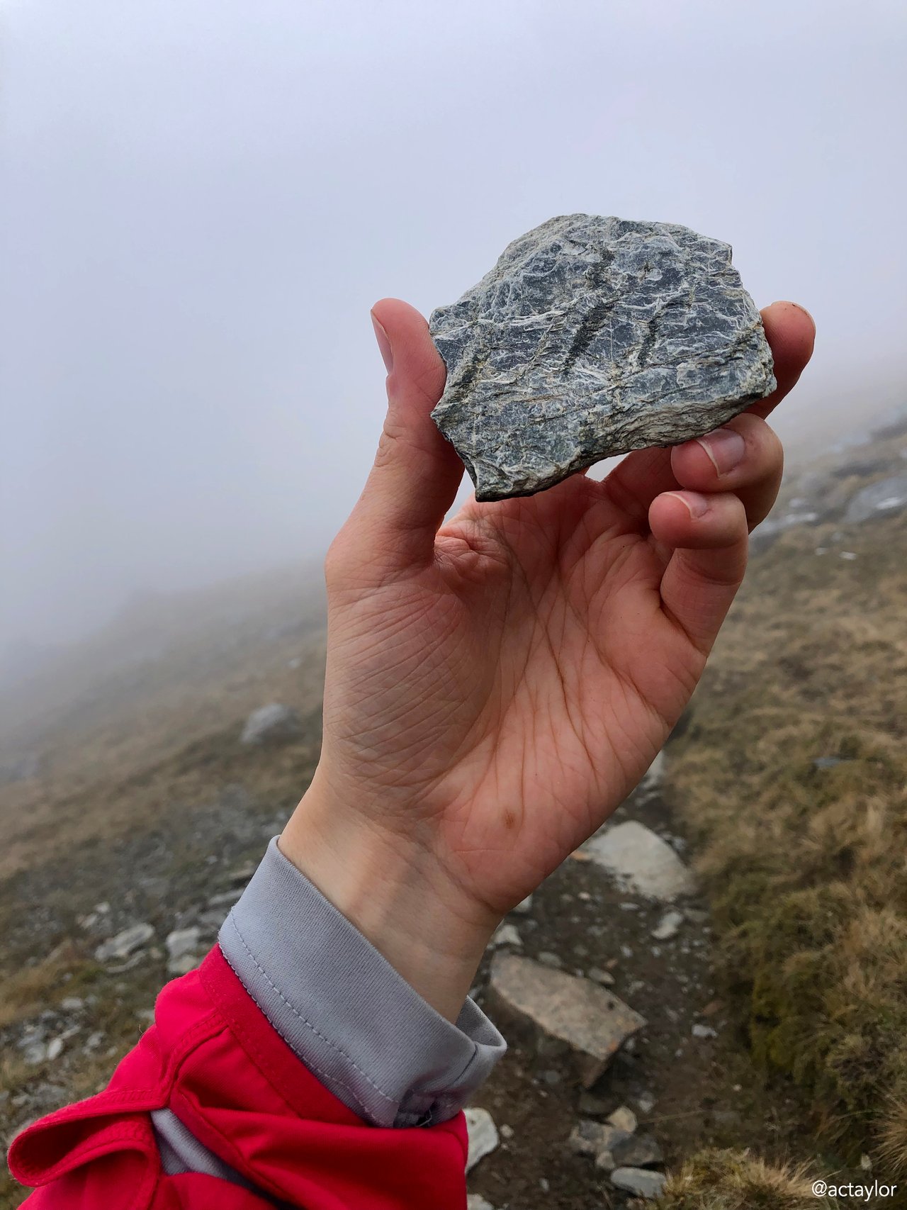
Between Am Bodach, the third peak of the day, and Sgòr an Iubhair, a brief Munro between 1981 and 1997, is an easy west ridge. I felt a little deflated after having reached the fourth peak that was no longer a Munro. Here I met several hikers coming in the other direction who were also disappointed that the point was no longer on the >3,000 ft’s list, thanks to the peculiarities of the Scottish Mountaineering Club's classification. Enroute, stray hands had collected a few more stones… (Do please correct me if I classify any of these incorrectly, @azircon!)
Shist and gneiss: formed through the intense heat and pressure of geological processes, creating the distinct layers and patterns seen in the rock faces. These ones were especially eye-catching for their silvery sheen and intricate banding.
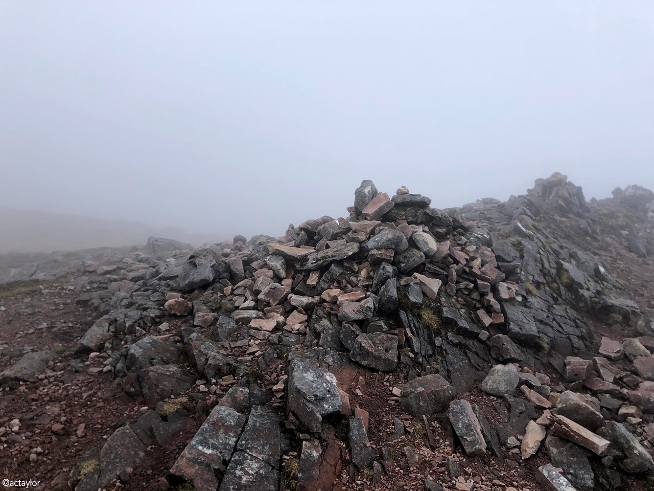
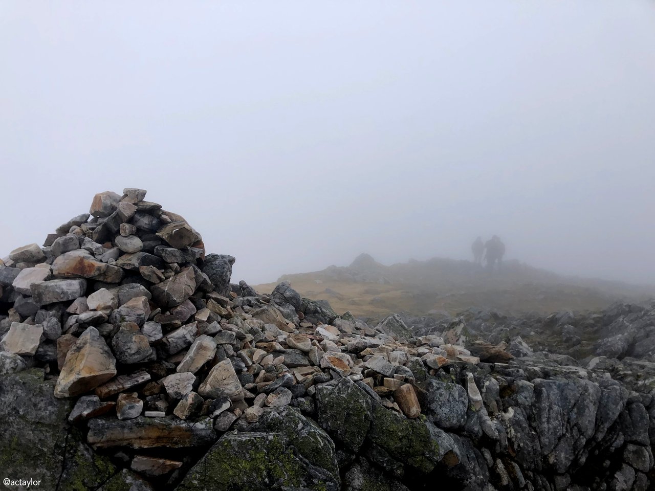
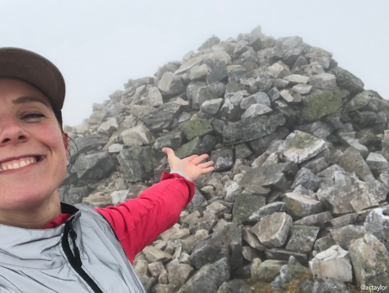
Limestone: this type of stone is often associated with karst landscapes and can contribute to the formation of caves, sinkholes, and other distinctive geological features. While not as prevalent as other rock types, limestone played a major a role in shaping the terrain of the final sumit on the Ring of Steall hike. Scattered deposits surrounded the final inuksuk – or cairn, as my fellow travellers described it. (The navigational landmark of stacked stones that indicate you’ve crested the summit of a mount!)
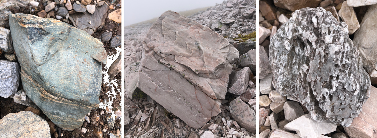 And the rocks that couldn't fit in my pockets
Finally, the route turned north, following 'The Devil's Ridge,' which begins with a descent NNW to a wide bealach before traversing the summit of Stob Coire a'Mhail along an exposed and snowy summit. I have to note that there are three forks in the road that are not immediately apparent on a Garmin or via Strava. And then the final descent… a long, strenuous downhill, slipping and sliding down sedimentary shale. The final and confirming reason I was delighted to have taken the clockwise route. I believe this section is far more fun on the descent than the incline. Past the shale, however, you reach a hard jagged and steep slope down... it'll leave you questioning whether or not to invest in a pair of bionic joints. Through the cloud cover and back to reality, I was greeted at the end with a warm salute by my wee blue bike locked to a post at the back of the carpark.
Later that night, in the campsite’s Glen Nevis pub, I nursed a well-deserved “Squirrel and Coo” lager with a side of chips. Chuffed, grinned the whole night through. The embrace of nature's vastness… where solitude becomes a sanctuary… give’s one an opportunity to be introspective – the raw beauty of the landscape and the quiet wisdom it imparts rewards and cleanses and strengthens. I absolutely love it.
I suppose I’d like to end this post by mentioning my sister's Facebook page, Wāhine Tramping and Hiking New Zealand. Reflecting on the transformative power of solitary adventures, my sister's journey with Wāhine Tramping and Hiking New Zealand echoes the profound impact of communing with nature on one's sense of self and community. What began as a modest endeavour to connect with like-minded women in a new city has blossomed into a vibrant online community of over 31,000 members, united by a shared passion for outdoor exploration and camaraderie. Through her initiative, she has cultivated a space where women can forge friendships, seek advice, and share their awe-inspiring tales of solo tramps amidst New Zealand's landscapes.
A lot of people have commented how “brave” and "dangerous" it is to camp and hike alone as a woman. And I’m curious if anyone here has any insightful comments that explore how femininity and mountaineering challenges traditional gender norms. I think what my sister hopes to achieve, and what I find so inspiring about the page she created, is that it invites women to reclaim their autonomy and embrace the untethered freedom of solo exploration. It's nice to be reminded of how wildly capable we are.
In a world where societal expectations often dictate our paths, the rise of solo tramping among women represents a bold assertion of agency and liberation. I myself would like to challenge the notion that wilderness pursuits are the sole domain of men, offering a poignant reminder that strength, courage, and resilience know no gender. Anyway, that’s my take on feminist adventurism in New Zealand, haha. But in all seriousness – can we stop congratulating women for being “brave” and “taking risks” by deciding to adventure off alone? Can we just recognise women’s innate capability and right to explore the world on their own terms?
I make a habit of embracing the boundless possibilities that await us beyond the confines of convention.
After all, life would be a little less enchanting without stones in it.
Which is a rather obscure metaphor to end on.
But hopefully it gets my point across.
Disclaimer
Blogger: @actaylor
Photographs: unless otherwise noted, all images were taken by me with an iPhone 8
Comments